
As part of my training for Braking AIDS Ride every year, it’s critical, psychologically as well as physically, for me to put in at least one century ride (a ride equaling 100 miles) prior to the ride event. In past years, I’ve tried to do at least two century rides, the first in late Jule or early August, but some years, between weather, time, travel, and the usual life-juggling factors, I’m only able to do one, and some years, the best way to get it done is to do my century when I’m on vacation. We go to Cape Cod for a week every year in early September, and I’ve taken to using one of those days to complete my century ride. I could rent a bicycle easily enough, but the more one rides, the more one is attached, emotionally and physically, to one’s own bike. So each year, we pack our two bikes into our car and drive them up to Cape Cod so we can ride them while we’re there.

The New Yorker approach to transporting two bikes up to Cape Cod: Two bike frames in the trunk, along with miscellaneous beach mats, helmets, and bike pump, and all luggage and kitchen supplies packed into the backseat. As you can see, The Blue Streak has been disassembled and stacked on top of Jen’s hybrid bicycle in the trunk of our rental car. Given the odd angles of the handlebars and the bicycle forks, it’s more of a challenge than you would imagine. Two wheels fit atop the two bikes in the trunk; the others went tightly wedged behind our seats in the car. Re-assembly is my first task upon arrival at our Drummer Cove, Wellfleet, destination.

Sadie, helping me navigate on our first morning on Cape Cod, driving from Drummer Cove, Wellfleet, to the Flying Fish Cafe in the center of town, where the world’s best scones and muffins are made. (It is a well-known fact that the Cape Cod muffin, which contains a mix of blueberries and cranberries, is the only muffin in the world I will praise openly and seek out actively.)
This year, I completed my 104-miler training ride on Tuesday, September 4. The maps below offer a visual view of my route, which began in South Wellfleet at Drummer Cove.

My starting point for my 104-mile bike ride: Drummer Cove, Wellfleet. The cottage we’ve rented for the past decade is one of about 6 to 8 small houses right next to the marsh and Drummer Cove. Tucked between Route 6 and the cove, the cottages are shaded by a copse of tall pines, so it’s surprisingly quiet and beautiful, despite the close proximity to the highway.

Map of Cape Cod. The detail of this map below offers a clearer view of my 104-mile ride route, but this map gives a better sense of the overall scale and distances covered.

Detail view of my 104-mile ride route, Outer Cape, September 4, 2013. My route began in South Wellfleet at Drummer Cove, proceeded to Provincetown and back to Drummer Cove for lunch, then down to South Dennis and back. The purple line shows my the first half of my ride, from Wellfleet through Truro to the West End beaches and dune bike trails of Provincetown and back to Wellfleet. The yellow line represents the post-lunch second half, from Wellfleet through Eastham, Orleans, Brewster, and Harwich to South Dennis and back again.
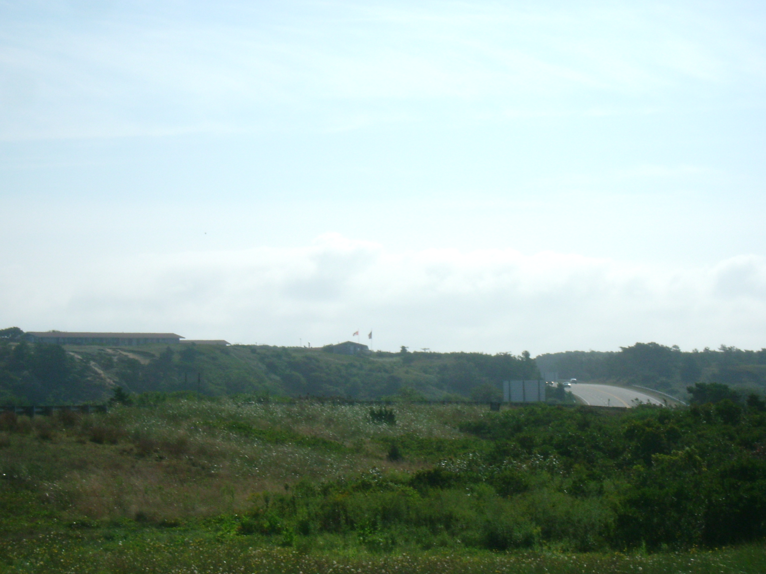
In the morning, when I left Drummer Cove, I began riding east on Route 6, the sole highway on the Outer Cape (with just one lane of traffic going in each direction for most of it), and made a quick left onto Lecounts Hollow Road to make my way to Ocean View Drive, which runs along the eastern coast and offers a cliff-/dune-side view of the ocean shoreline and the beaches of Wellfleet. It’s also a road that’s less trafficked by cars than the highway and is not only more scenic, but hillier and windier, and therefore more challenging riding terrain. At the end of Ocean View Drive, the road splits one last time, and you can either take a left onto Gross Hill Road and Gull Pond Road, heading westward back toward Route 6 and Wellfleet Center, or you can take Ocean View down a sloping hill to its end at Newcomb Hollow Beach. I did both, coasting down Ocean View, stopping briefly at Newcomb Hollow Beach to take the photos below, then turning around to climb back up the hill to the intersection with Gross Hill Road. I then headed along the gentle rolling hills of Gross Hill and Gull Pond Roads, cool and shaded by scrubs pines and red cedar trees, passed Gull Pond and back toward the highway. Where Gull Pond Road meets Route 6, I took a right onto the highway, passing the best source of fried clams and other deep-fried seafood delights in the area: Moby Dick’s Restaurant.

A foggy, chilly, overcast morning at Newcomb Hollow Beach, Wellfleet. It was just cold and windy enough that I wore my arm warmers for the first 10 miles of my ride.
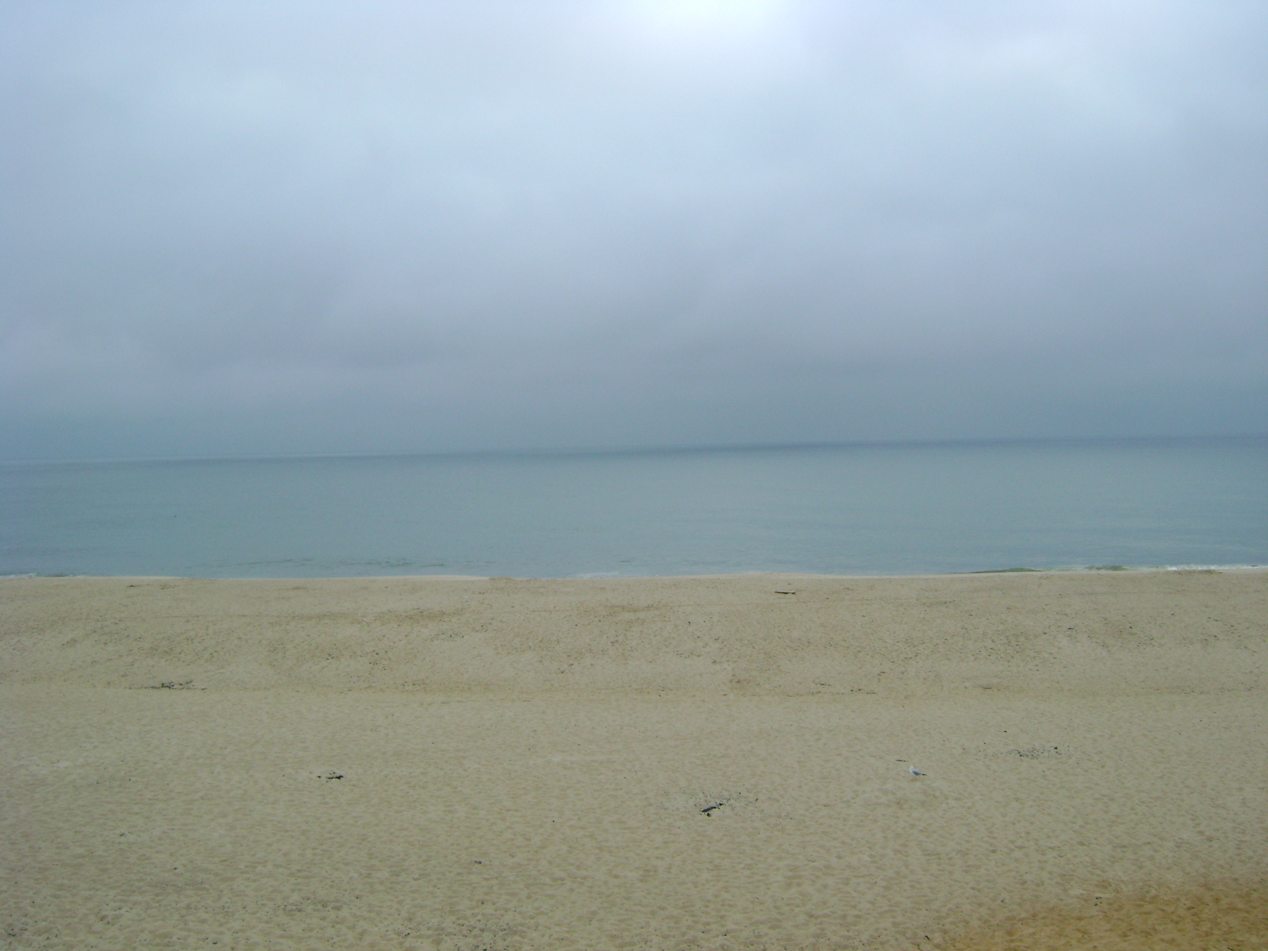
Newcomb Hollow Beach, Wellfleet, morning of September 4, 2013, about 8 miles into my century ride.
The sky was overcast and gray as I rode along Ocean View Drive. It was chilly and no one was on the beach. I wasn’t sure it would clear up at all and was prepared to ride the bulk of my century ride in the rain. But the weather on the Cape can change in a heartbeat, and that Tuesday morning was no exception. The clouds burned off and by the time I made my way past Gull Pond and back to Route 6 heading east to Truro, less than 15 miles into my ride, the sun was out and the arm warmers came off. I rode on Route 6 for another 6 miles, until it meets Route 6A, also called Shore Road, which runs right next to the bay side of the western Outer Cape Cod coastline, and then I took Shore Road the rest of the way to Provincetown. It was still early morning, so town was quiet as I rode down Commercial Street from the East End to the West End of Provincetown. Once I got to the West End of town, I turned right on Province Lands Road, and headed first to Herring Cove, where I took off my biking shoes, waded into the water, and leaned over to wet my head and cool off. From there I traversed the Province Lands biking trails that wind up and down through the stretch of dunes and marsh grasses between Herring Cove and Race Point, where I stopped again to eat a power bar and rest.
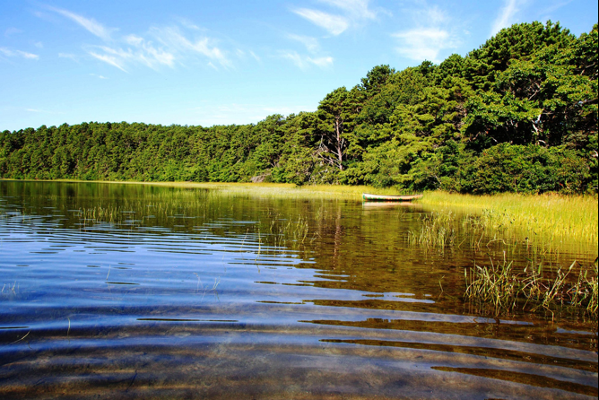
Gull Pond, Wellfleet.

Moby Dick’s Restaurant, Wellfleet, from the intersection of Gull Pond Road and Route 6. Yes, the sign really says, “For a Whale of a Meal.” Don’t let that deter you if you’re ever in the vicinity. The seafood is excellent, and one entrée is great for two people to split.

The decor inside Moby Dick’s Restaurant, Wellfleet. Lots of nautical-themed curios and knick-knacks: fish, fishing nets and traps, buoys, anchors, all lit by holiday lights strung along the rafters. During my century ride, it was too early to stop for a snack, sadly—Moby’s doesn’t open until 11:30am for the early-bird lunch crowd—but we did eat there one evening during our stay. Mmmmm…. clam strips. Fried good good is good good!

Hilly terrain in Truro, from Shore Road/Route 6A.
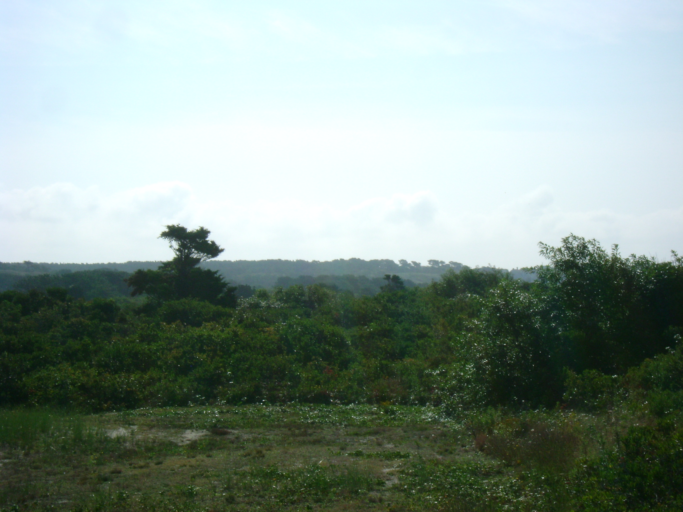
Scrub pines and woods in Truro, about Mile 20 of my ride for the day.
Beach cottages overlooking the bay along Shore Road/Route 6A, Truro.

Truro, facing east and Route 6, from Stotts Crossing, a tiny little strip of connector road linking Route 6A, the shore road, with Route 6, the only highway on the Outer Cape.
View from Shore Road/Route 6A in Truro, facing west, back toward Wellfleet, with Route 6 in the distance.

View of rowboats on the water, along Shore Road, Truro.

Pilgrim Lake and dunes, Truro, facing east from Shore Road.

Hazy view of Provincetown in the distance, from Shore Road/Route 6A, Truro.
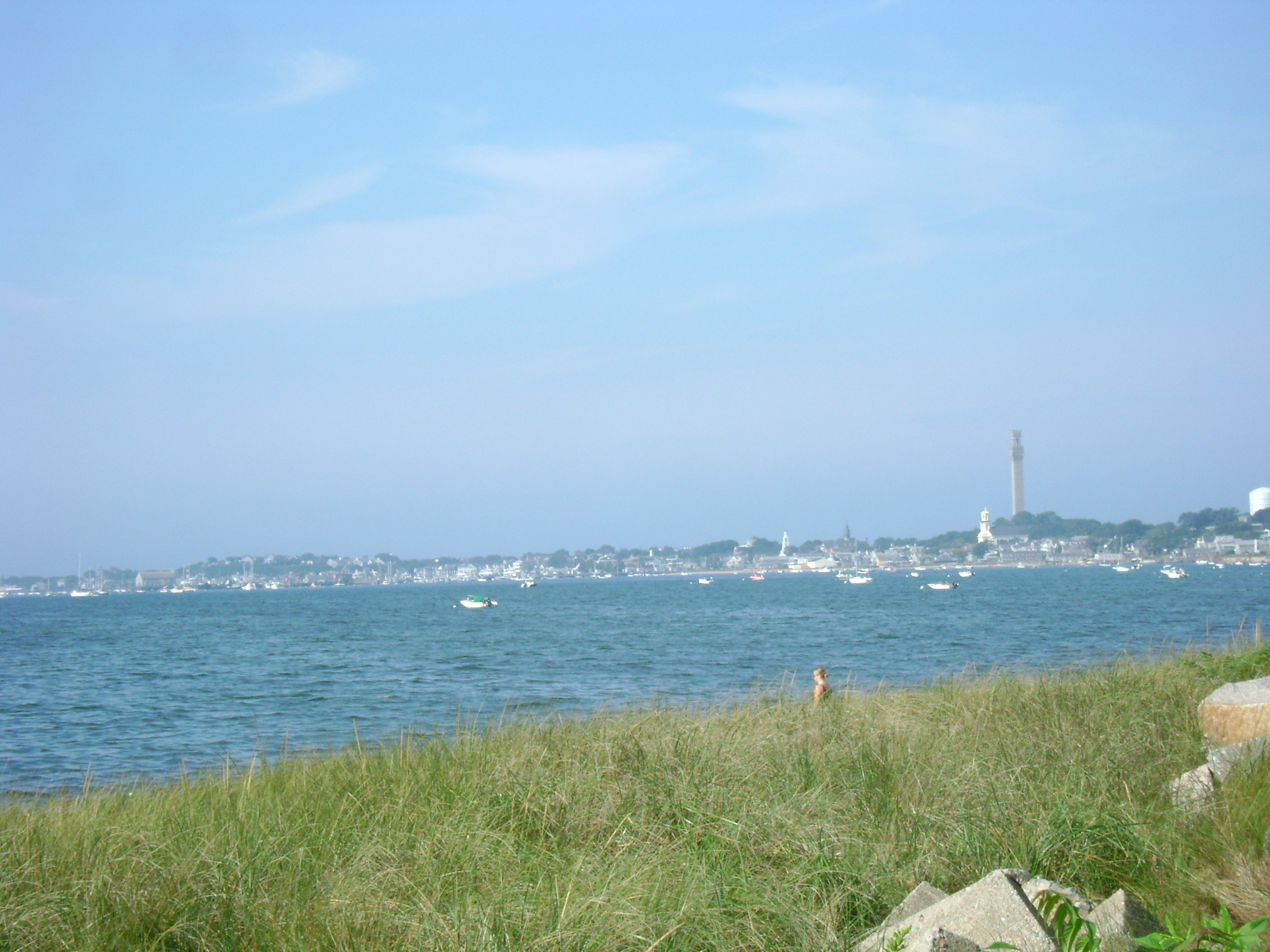
Another view of Provincetown, farther along Shore Road/Route 6A, Truro. The haze had burned off, and the day was starting to heat up.

The West End Breakwater, Provincetown. In the distance, to the right of the breakwater’s vanishing point, the tiny bump in the horizon line is Woods End Lighthouse.

The marshes in the West End of Provincetown.
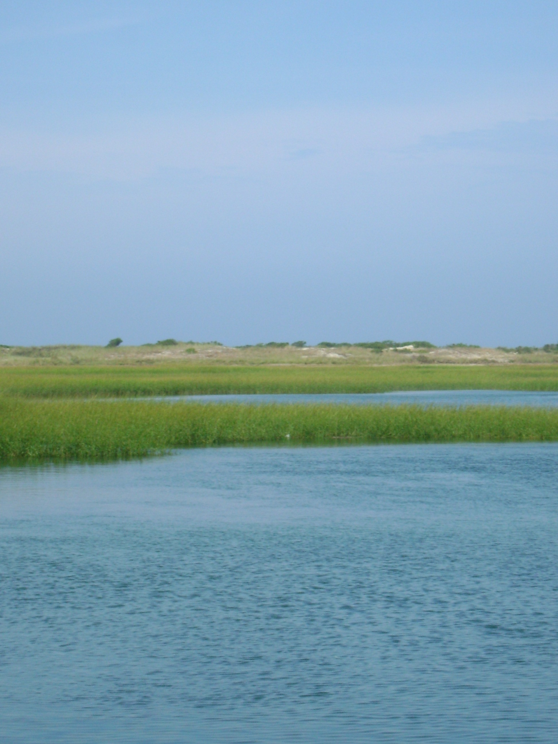
Another view of the marshes in the West End of Provincetown.

March grasses, reeds, and dunes in the West End of Provincetown.

Herring Cove Beach, Provincetown.

Herring Cove Beach, Provincetown, moments before I waded into the water to cool off.
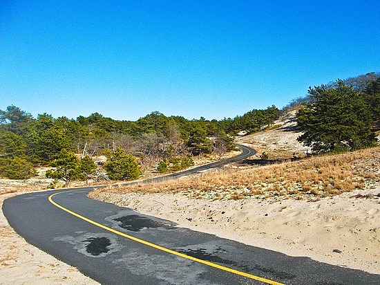
One of the Provincelands bike trails between Herring Cove and Race Point, Provincetown.
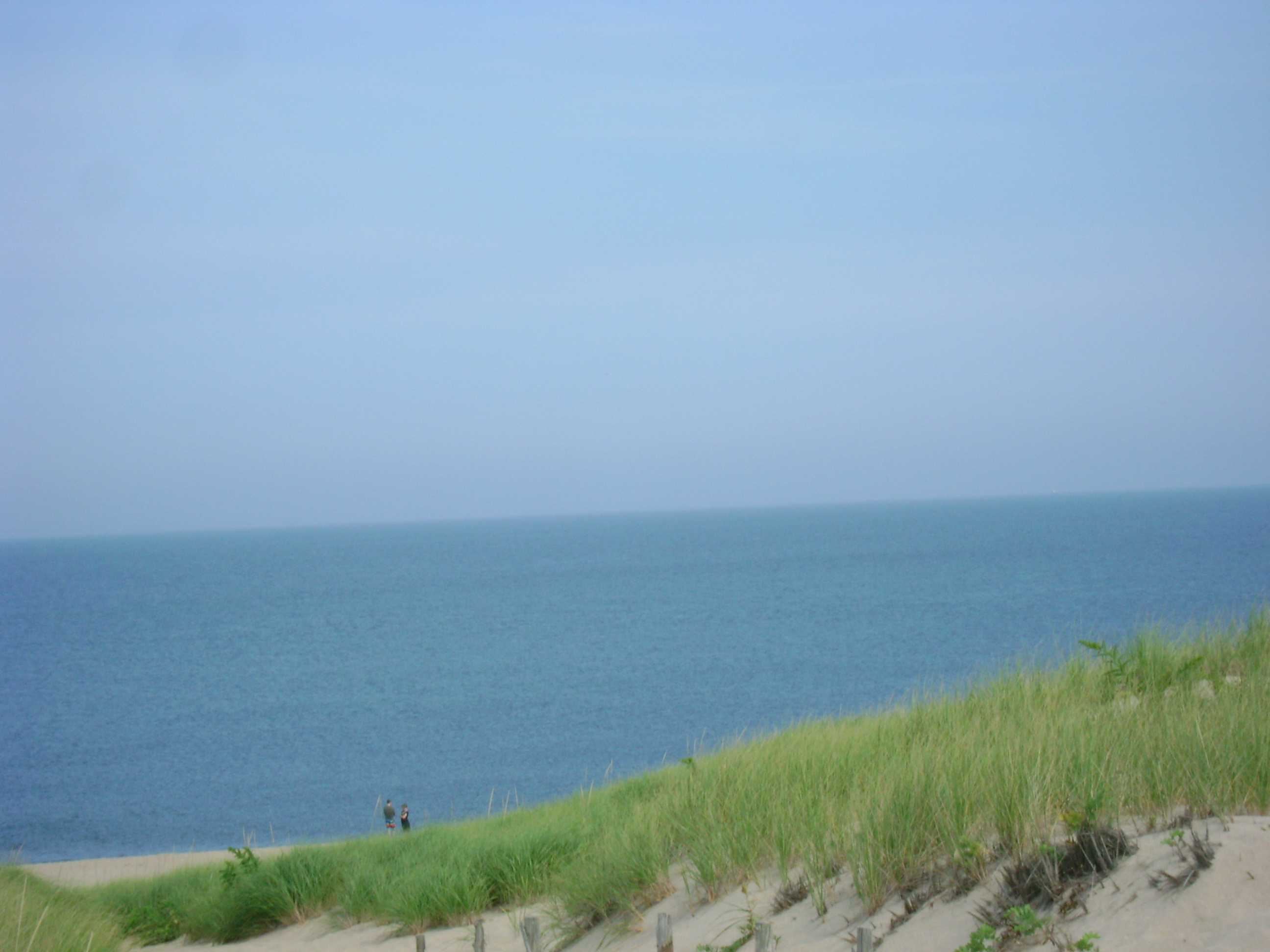
Overlooking Race Point Beach, Provincetown.
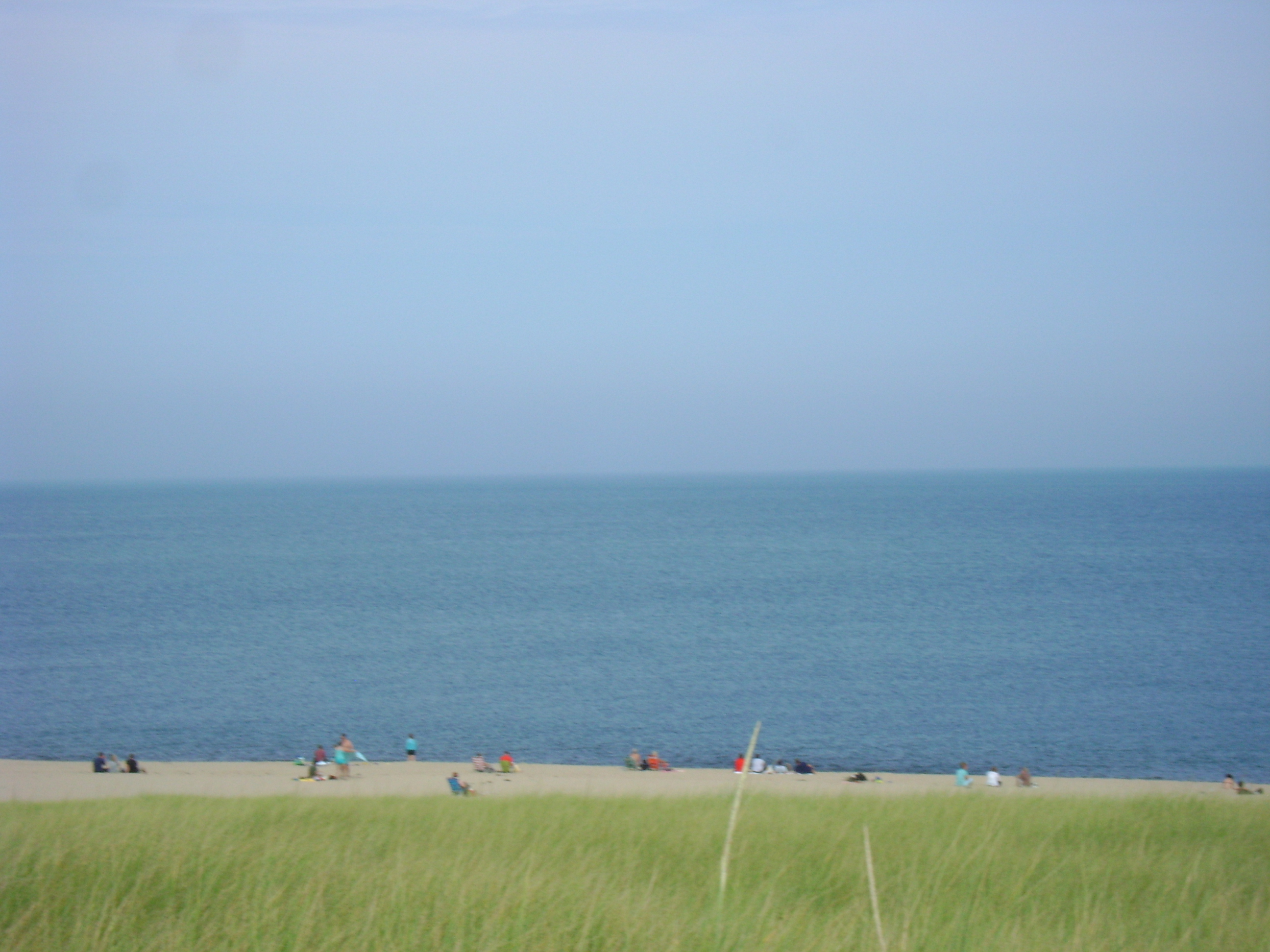
Sun bathers on Race Point Beach, Provincetown.
Before leaving Provincetown, I stopped at the gas station on Shankpainter Road to replenish my water and Gatorade bottles, and then I headed back to Wellfleet, riding Route 6 out of town, then picking up the Shore Road again going home, though I did take a couple of detours to do some additional hill riding along the way. One of the nice things about doing this century ride route is that after my first 50 miles, I get to stop back at home for lunch before doing the second half of it. That meant that in addition to having a delicious sandwich waiting for me, I got to snuggle with my partner and our dog for a few minutes and I had the luxury of being able to trade my sweaty, soaked-through jersey for a clean, dry one.
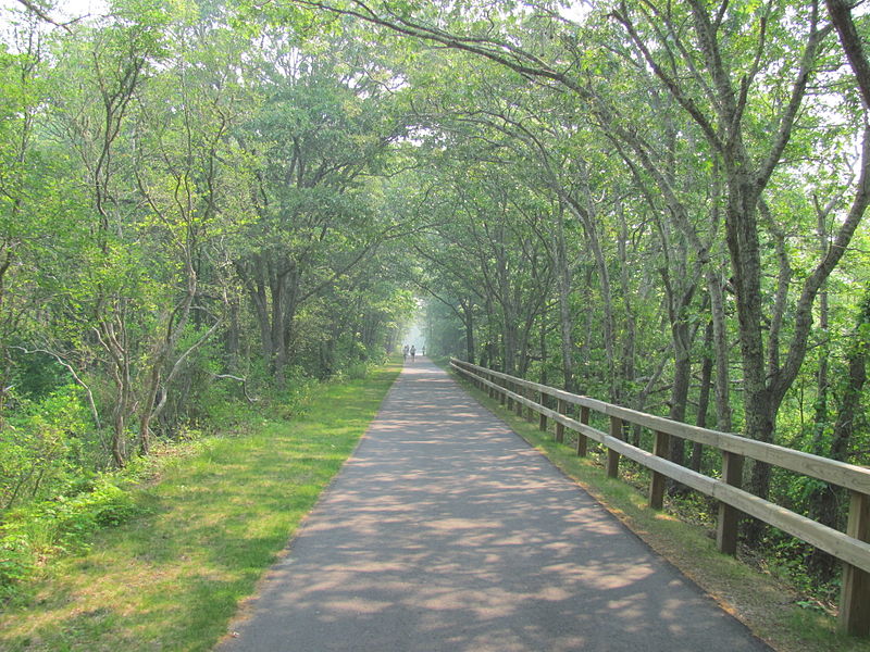
The remaining 50 miles were easy riding in terms of the terrain. The Cape Cod Rail Trail from Wellfleet to Dennis is relatively flat and it’s also 44 miles total, 22 each way. Because that would leave me 6 miles short of a full century and because I knew I need to put in some more hills before the day was over, I backtracked and re-did my route along Ocean View Drive again before heading to the Wellfleet entrance of the rail trail on Lecounts Hollow Road.
Unlike the rest of my route, much of the trail is overgrown with trees and offers more shading from the elements than most of the roads on Cape Cod. This turned out to be fortuitous because the weather took another 180 turn. Ocean View took me less than half an hour, but by the time I began on the rail trail, the sky was turning gray again, with heavier cloud clusters than those of early that morning. The first downpour hit when I was in Eastham, the next town over from Wellfleet. That lasted about 15 minutes and then stopped before I reached the town line between Orleans and Brewster, at about Mile 10 of the first 22 to Dennis, but the light stayed green-ish and dark, and it was clear from the strange glow cast on the pavement and on the wet trees that more rain was coming. I got to the Dennis end of the trail with no further rain beyond a few spittles here and there, but I literally didn’t have time to do more than eat a power bar and send a text message to Jen telling her I was heading back and doing my last 22 miles before the sky darkened and rumbled and a flash of lightning struck along the horizon. The sky opened up almost as soon as I got back on the Blue Streak, so I didn’t dawdle, and I pedaled like hell the 22 miles back home, tearing through the near-knee-deep puddles flooding the trail, with the rain coming down in sheets the whole time.

Cape Cod storm clouds gathering, before a deluge. The thunderstorm that drenched me all 22 miles back from Dennis to Wellfleet swooped in so fast, I didn’t stop to take out my camera, which would have gotten soaked and ruined. But the storm clouds depicted here, of another Cape Cod rainstorm, give a pretty accurate idea of what the sky looked like just before it started to pour during the last 22 miles of my century ride on September 4, 2013.
The Cape Cod Rail Trail, Brewster, on a different, sunnier day.

The Cape Cod Rail Trail, again on a different, sunnier day. Several small metal tunnels appear along the 22-mile rail trail between Wellfleet and Dennis. I include the image of this one because the storm I rode through became so severe, that when I was about to pedal through one of them, not only was it flooded, it was also occupied by more than a dozen wet people and several bicycles. One by one, cyclists, walkers, and runners had ducked into one of these metal tubes during the storm because, except for a campground area somewhere in Brewster with a hut that houses a public bathroom, these tunnels offer the only shelter on the rail trail itself. The tunnel was packed with people and I was already soaked and intent on getting home, so I didn’t stop with them, but they clearly intended to either wait the storm out or wait until the rain lightened. I rode at least another 12 miles after I encountered these folks and it poured the whole time, so they must have given up and braved the elements or stayed there, cold and wet, for a good, long time.
I was never happier than when I opened the door to our little Drummer Cove cabin. The Blue Streak and I were drenched, so I stripped out of my cycling clothes in the doorway in order not to trek water and mud and sand into the house, and then I wiped the bike down and emptied the saddle bag and hung it from a rack in the bathroom, so rainwater wouldn’t drip and pool on the floor as everything dried.
I got back home to Drummer Cove in the nick of time, it seems. The storm worsened, and pounded down on our cottage for the next five and a half hours, all through the evening. My rewards for making it through 25 miles of cycling under torrential showers were numerous and simple and full of tactile pleasures, a hot shower, dry clothes, an evening relaxing on the couch with my wife and my dog, a massage, cold beverages of all kinds (hydrating water and seltzer and juice, followed by a glass of crisp white wine), a delicious dinner of fresh seafood and grilled vegetables, and the sight of this distance on my bike odometer:

What joy: A 104-mile bike ride, completed.

You are amazing!